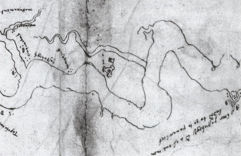
From The Encyclopedia Virginia, The Virginia Foundation for the Humanities:
“The Zúñiga chart, a manuscript map of the Chesapeake Bay and Tidewater Virginia, features the bay’s major rivers, the location of Jamestown and James Fort, and the locations of sixty-eight Indian villages. The chart, probably a copy of a map made by Captain John Smith, was sent to King Philip II of Spain by Don Pedro de Zúñiga, a Spanish ambassador to England.”